+86 13750873347
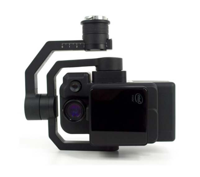
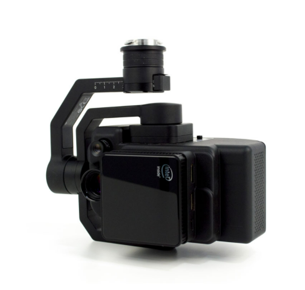
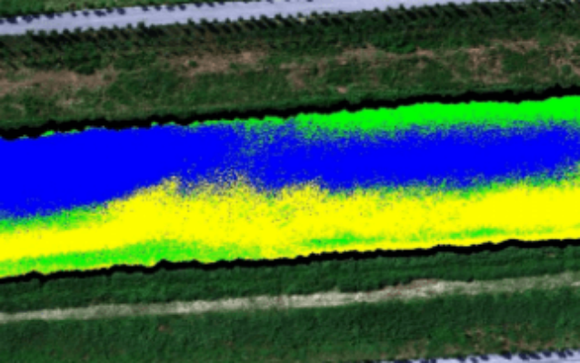
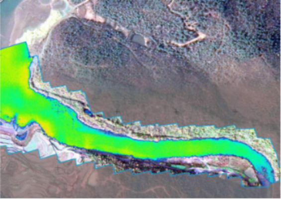
FS-50 series multi-spectral camera
Multi-channel, meet a variety of industry application requirements
  • FigSpec FS-50 series is a new generation of UAV-based multi-spectral camera launched by Color Spectrum Technology Company, adapted to DJI M350/M300RTK flight platform, with 30-480 spectral channels and 2K resolution.

    It can meet the application needs of precision agriculture, military defense and homeland security, disaster prevention and forestry monitoring, river and lake ecology, target identification and other industries.

    Ultra-high spectral channels: 30-480 spectral channels (different models)
    2K spatial resolution
    Global shutter, 12bit high precision sampling data
    Ground station real-time preview data acquisition
    DJI X-Port control and power supply, 512GSSD mass storage
    Dji M350/M300 RTK UAV customization, plug and play
    FIGSPEC UAV real-time flight control software, FIGSPEC Merage puzzle software, FIGSPEC Studion image analysis software
  • Contact Now
    Get Best Price
Leave a Message
X
*
*
*
Leave a Message
X
*
  • Crop growth assessment

    FigSpec Studio software is built with NDVI and other vegetation factors to accurately quantify the state of vegetation canopy at different spatial scales, quantitatively assess the health, stress and growth of crops and vegetation, and provide data support for crop growth assessment, yield prediction, disease and pest detection, etc.


  • Coverage evaluation

    Based on the spectral fingerprint information of plants, accurate classification of plants in the region and crop area statistics are carried out to provide quantitative vegetation canopy data to provide data support for scientific research and production of agriculture and forestry ecological industry.


  • Water quality analysis and monitoring

    Using the spectral data and chemical analysis results, the analysis model is constructed to realize the inversion of the classification and water quality parameters of black and odorous water bodies. Combined with spatial information to monitor the impact of domestic sewage and industrial wastewater on surrounding water bodies, help pollution source investigation and water environment assessment.


  • Water eutrophication monitoring

    Spectral data are used to form a classification index to monitor water eutrophication and conduct spatial information statistics. Following the evaluation standards of water eutrophication status, it assists in analyzing water pollution sources such as farmland, aquaculture and fishery, and provides data and powerful data collection tools for pollution source investigation and water environment assessment.


Technical specification

model

FS-50/30

FS-50/60

FS-50/90

FS-50/120

FS-50/150

FS-50/180

Number of spectral channels

30

60
90
120
150
180

Spectral channel wavelength

400-1000nm

output one wavelength

every 20nm

400-1000nm

output one wavelength

every 10nm

400-1000nm

output one wavelength

every 6.66nm

400-1000nm

output one wavelength

per 5nm

400-1000nm

output one wavelength

per 4nm

400-1000nm

output one wavelength

per 3.33nm

spectrum resolution ratio /Half-wave width

3.5nm

3.5nm

3.5nm

2.5nm

2.5nm
2.5nm

Space resolution

1920

sampling rate

128 line/S

imaging sensor

1/1.1 inch CMOS

effective pixels

1920

Shutter type

global shutter

digitalizing bit

12bit

Visualfield

25.36°

ground resolution

2.8cm@h120m

Covering width

54m@h120m

optical window

High transmittance optical glass window

Main engine size

≤155*95*119mm

Main engine weight

≤840g

Installation/power supply port

X-Port

Workloss

45w

picture format

12bit.SPE.spe(compatible withenvithird party analysis software such as envi)

Data storage space

512SSD

application software

FIGSPEC UAV,FIGSPEC Merage puzzle software,FIGSPEC Studion image analysis software

photography method

real-time collection


Related products
Relevant cases
请填写下面的表格以获取更多信息
*
*
*