- 中
- +86 13732210605
Author:
In today's increasingly important context of environmental protection and water resources management, accurate and efficient detection of water quality has become a key task.
Traditional water quality detection methods often have many limitations, such as limited sampling points, long detection cycles, and difficulty in achieving large-scale real-time monitoring. However, with the rapid development of science and technology, the emergence of drone hyperspectral technology has brought revolutionary breakthroughs in water
quality detection, just like giving us a pair of wings that can overlook the entire water area and perceive its subtle changes.

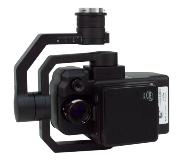
FS-50 Multispectral Camera

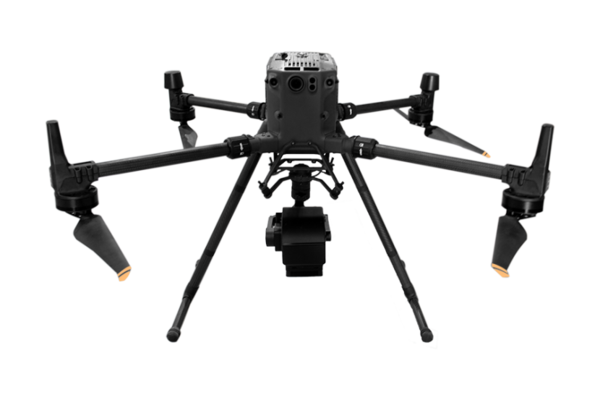
UAV Hyperspectral Measurement System

1. Advantages of UAV hyperspectral detection of water quality
(I) Rapid monitoring of large areas
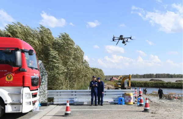
UAVs can fly quickly over large areas of water, obtain a large amount of hyperspectral data in a short time, and realize comprehensive monitoring of large areas
of water. Compared with traditional manual sampling and laboratory analysis methods, it greatly improves the monitoring efficiency, can timely detect
abnormal changes in water quality, and provide timely decision-making basis for water resource management and pollution prevention.
(II) Non-contact detection
UAVs conduct remote sensing monitoring of water bodies at high altitudes without direct contact with the water body, avoiding the secondary pollution of the
water body that may be caused by traditional detection methods, and also ensuring the safety of detection personnel. This non-contact detection method
can also monitor some dangerous or difficult-to-reach waters, such as the deep sea and heavily polluted rivers.
(III) High spatial resolution
Hyperspectral imagers can provide images with high spatial resolution, clearly distinguishing different areas in the water body and small differences in water
quality changes. This is of great significance for identifying the location of pollution sources, monitoring the spread of water pollution, and evaluating the
water quality of local waters. By combining with the Geographic Information System (GIS), water quality monitoring results can be intuitively displayed on
the map, providing more detailed and accurate information for water resources management and planning.
(IV) Multi-parameter simultaneous detection
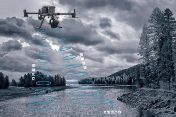
As mentioned above, through hyperspectral data analysis, information on multiple water quality parameters in the water body can be obtained simultaneously,
such as suspended solids, chlorophyll, COD, dissolved oxygen, etc. This not only reduces the tedious process of performing multiple tests separately in
traditional detection methods, but also enables a more comprehensive understanding of the comprehensive status of water quality, providing richer data
support for water quality evaluation and pollution cause analysis.

2. Application Cases and Practical Results
(I) Lake Water Quality Monitoring
In the water quality monitoring of a large lake, the UAV hyperspectral technology was used to patrol the lake regularly. Through the analysis of hyperspectral
data, it was found that the chlorophyll content in some areas of the lake was abnormally high. Further investigation found that it was due to eutrophication
of water bodies caused by surrounding agricultural non-point source pollution. Relevant departments took timely measures, such as strengthening
agricultural pollution control and implementing ecological restoration
projects, which effectively curbed the trend of water quality deterioration. At the same time, UAV hyperspectral monitoring also provides continuous
data support for long-term research on lake ecosystems, helping scientists to better understand the changing laws of lake ecological environment.
(II) River pollution monitoring and tracing
In the monitoring of a river polluted by industry, UAV hyperspectral detection found that there were specific spectral feature anomalies in a certain section
of the river. After analysis, it was determined that a certain heavy metal pollutant exceeded the standard. By flying along the river and continuously
collecting hyperspectral data, combined with the data analysis model, the location of the pollution source was successfully traced, providing key evidence
for the law enforcement and pollution control of the environmental protection department. In addition, during the pollution control process, UAV
hyperspectral monitoring can also track the control effect in real time and evaluate the effectiveness of control measures.
(III) Protection of drinking water sources
UAV hyperspectral technology plays an important early warning role in the protection of drinking water sources. By regularly monitoring water sources,
potential pollution threats such as illegal sewage discharge and algae outbreaks can be discovered in a timely manner. Once abnormal water quality is
detected, relevant departments can take measures quickly to ensure the safe supply of drinking water. At the same time, drone hyperspectral monitoring
data also provides a basis for the scientific management and protection planning of water sources, which helps to formulate more reasonable protection
measures and emergency plans.
This article is provided by Caipu Technology. For more details, please visit Caipu Technology's official website.
Caipu Technology (Zhejiang) Co., Ltd.'s products are widely used in agriculture, forestry, water quality, plastic products, coatings, food safety and medical
testing, and the scope of application continues to expand. The company insists on technology research and development, improves service levels, and
ensures product stability. The company's main business is a series of optical testing equipment such as hyperspectral cameras, colorimeter, spectrophoto
meter, gloss meter, etc., which can provide users with effective solutions. Welcome to consult.

